
Geothermal areas are widespread in Iceland. No wonder, really: the country sits right on the rift between the North American and Eurasian continental plates and, on top of that, directly above a huge magma plume. There are only a few places in the world where you can get as close to the inside of our planet as on this small island in the North Atlantic — in some spots you can even feel the heat with your hand on the ground.
In this post we want to introduce you to the most beautiful geothermal areas in Iceland, with information on what there is to see and how to get there. Plus a few tips, a map and plenty of useful facts.
Here we go…
What is a geothermal area?
First of all, let’s explain what a geothermal or high-temperature area actually is. A high-temperature area is defined by the temperature of the groundwater at a depth of around 1 km: if it is higher than 150°C (the boiling point is shifted because of the pressure), it is called a high-temperature area. If it is below that, it’s a low-temperature area.
At the surface this usually shows in the form of vents where the hot water escapes: hot springs, geysers, fumaroles or solfataras. All of these formations are basically nothing more than valves for the pressurized water that is searching for a way to the surface. Most readers will have heard of geysers like Strokkur in Iceland or Old Faithful in Yellowstone National Park in the USA. These water-spouting holes in the ground are probably the most impressive form. By far the most common, however, are fumaroles and solfataras. Fumaroles are vents that release gas and usually smell of rotten eggs: hydrogen sulfide is the culprit, and it usually escapes together with water vapor. You shouldn’t inhale too much of it, but that’s not hard to avoid because the gas collects close to the ground. Solfataras often appear as wildly bubbling holes filled with a kind of mud: this is partly dissolved rock, because sulfuric gases escape from these openings, combine with the water to form acid and dissolve the stone.
How to behave in Icelandic geothermal areas
There are a few rules to follow in high-temperature areas — for your own safety, and also to protect the fragile nature from human impact, so that visitors after you still have something to marvel at.
If you’re reading this with a bit of common sense, you’ll already have guessed it: hands off! Geysers, fumaroles and solfataras absolutely do not like being touched — and if in doubt, they will let you feel it! Scalds, burns and even chemical burns can be the result, and they are anything but pleasant! Many people think the bubbling comes only from the gas, assume the water isn’t hot, and then stick a finger in: I tested that for you once, so you don’t have to anymore 😉
Many geothermal areas have wooden paths that were built with a lot of effort: use them, respect the barriers and enjoy the information boards that are usually set up. That way, visitors after you can also admire these places in good condition.
The Seltún geothermal area in Iceland’s Krýsuvík region
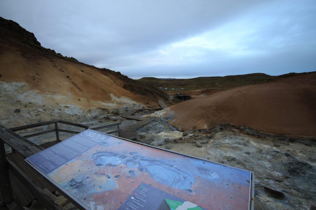
One of the better-known geothermal areas of Iceland lies just under an hour’s drive south of Reykjavík, or east of the airport in Keflavík. In the volcanic region of Krýsuvík you’ll find the high-temperature area Seltún — both names are often used interchangeably. The area sits right next to road 42 and is hard to miss; next to a small hut there is a parking lot with room for a number of cars and buses.
From the parking lot you can walk up the small hill on a wooden path and admire all kinds of formations along the way. From mud pots to steaming rock formations to small pools, almost every variety can be found here. Unfortunately there is no geyser, but you should still keep your distance from the boiling waters — here and there they spit a few drops quite a bit further than you would expect.
Along the way there are several information boards, and reading them really is worthwhile, because you can learn a lot about geothermal areas here. For example, that the water at a depth of 1000 m is more than 200°C hot, and that energy was produced here until 1999, when the plant finally exploded. Insider tip: if it’s cold, just take photos of the boards and read them later in the warm car! 😉

If you’re reasonably fit, you can also climb the whole hill and enjoy a great view from the top, over the area all the way to the sea. You should plan a good hour in total for this, depending on how much time you want to spend up on the mountain. There are also toilets at the hut, but they are usually closed, especially in winter.
North of Seltún lies the dynamic lake Kleifarvatn. Dynamic because, on the one hand, large parts of it regularly disappear underground before it slowly fills up again — and on the other hand because you can see the volcanic activity directly in the lake. When snorkeling or diving you can see gas bubbles rising everywhere, and often dancing sand vortexes on the bottom. The whole region is alive and volcanically active — an exciting place to experience the volcanic forces of the earth’s interior up close!
The Hverarönd / Hverir geothermal area in Iceland’s Mývatn region
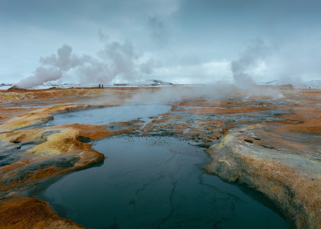
A few kilometers south of one of Iceland’s largest volcanoes, Krafla, lies Hverarönd, or Hverir, as the high-temperature area is also called.
It stands out above all for its relatively wide landscapes, which create a wonderful impression of vastness and remoteness. In many spots the area is calm and not very active, in others it bubbles and steams wildly. All in all, Hverarönd is somewhat less developed for tourism than the areas in the south and west of the country, but paths and barriers have been installed here as well by now.
In the wider surroundings there are several geothermal power plants, and for a long time the construction of one was also considered in the high-temperature area itself. Drillings have proven extremely high temperatures at just a few hundred meters of depth, but concerns from residents and conservationists have so far prevented a power plant from being built here.
Right next door is the Mývatn region with the famous lake, the Mývatn Nature Baths and the hot spring Grotagja. All in all, a great option for a varied day trip in the north of Iceland.
You reach Hverarönd via the Námaskarð pass, directly from the Ring Road. Many sights are packed closely together here, which is why the area is often associated with the Diamond Circle, an alternative to the Golden Circle in the south-west.
The geothermal area around Reykjadalur in the south of Iceland
The high-temperature area in Reykjadalur, which translates to “Steam Valley”, offers not only geothermal sights but above all a geothermally heated river. After the hike into the hills above Hveragerði you can get in and enjoy the roughly 38°C warm water. A special experience, particularly in winter.
Today this area is very developed for tourism — especially in high season you won’t be alone here anymore and will have to share the view, and probably your spot in the water, with the other visitors. All the more important to set a good example and focus on sustainability.
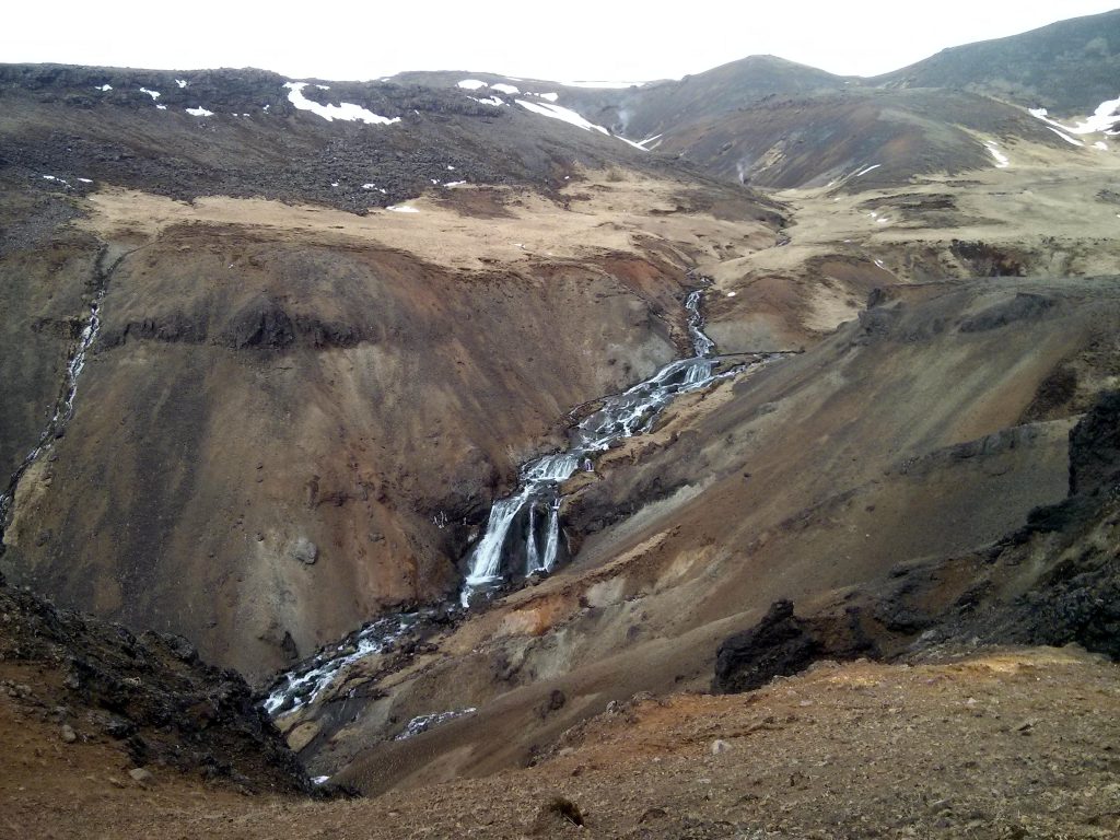
The hike starts a little above the small town of Hveragerði and takes you over 2–3 hours through the gorges of the small mountain. Besides the great landscapes, you often have wonderful views of the river and its waterfalls. The bizarre formations created by the volcanic activity are then a bit like little cherries on the big dollop of cream that the whole region represents. Many large mud pots and steaming rock formations line the way. Turquoise pools and steaming springs all along the path make every meter an experience.
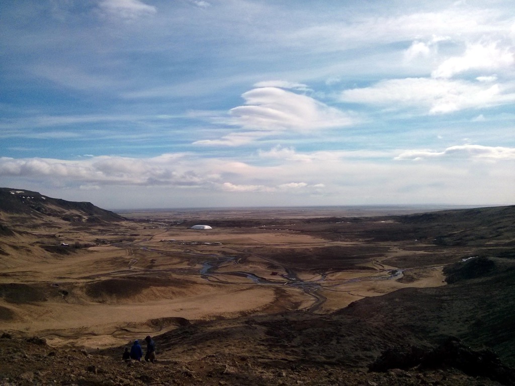
Once at the top, you find yourself on a kind of plateau, a large meadow with a view of the mountain peak and many small bathing spots in the river. Here the water is dammed up with stones or wooden boards, and the hot springs flowing in from the sides warm the otherwise ice-cold river to pleasant temperatures.
Reykjadalur fits perfectly into a day trip along the south coast or an extended tour of the Golden Circle. You should bring enough time though, because the hike is not to be underestimated if you still have a full day ahead of you afterwards. I wouldn’t recommend doing the hike in the dark, as you would miss out on the great views.
Here you can find the Reykjadalur hike on GPSies.
Haukadalur, the geothermal area with the geyser Strokkur
Probably the best-known and most-visited geothermal area in Iceland is part of the Golden Circle in the west of the island and goes by the name of Haukadalur.
Besides many small fumaroles and mud pots, there is one sight here above all that you won’t find anywhere else on the island: the particularly active geyser Strokkur. Reliably every 5-15 minutes, Strokkur erupts and hurls a cloud of water and steam dozens of meters into the air. Sometimes more, sometimes less spectacular. So if you only managed to catch a smaller eruption on camera, don’t be annoyed — just wait a few minutes.
You can use that time to explore the area, because besides Strokkur there is also Geysir. That’s right: THE Geysir. It gave all its small and big siblings, like ‘Old Faithful’ in Yellowstone National Park, their name. Today it is not very active and erupts only very, very irregularly.
There are also a few hot springs here, but bathing in them is forbidden — with the large numbers of visitors it simply wouldn’t be hygienic anymore.
From here you usually continue east to the waterfall Gullfoss and, on the way back, perhaps to the waterfall Bruarfoss. If you like, you can also stop at the hot springs of Fontana or the Secret Lagoon. By the way, in the Iceland app you can find a Golden Circle tour with audio commentary for self-drivers.
Hengill, the remote geothermal area at Þingvellir National Park in Iceland
Right by Þingvellir National Park lies the Hengill volcanic system. It contains several central volcanoes, and eruptions thousands of years ago created huge lava fields all around. The whole area is still volcanically active, and so the Hengill high-temperature area is home to dozens of hot springs and many fumaroles, and the entire landscape steams in many places.
Basically, you are here on the other side of Reykjadalur, which is not unusual: the rift between the continental plates runs from north to south through the whole country, and volcanic activity is accordingly likely along it.
You can’t get here by car, but there are other ways: probably the most exciting one is a sightseeing flight by helicopter. In October 2017 I joined a helicopter tour from Reykjavík, which includes a landing in the Hengill area. Here you can take your time to look around and experience up close the area you just admired from a bird’s-eye view.
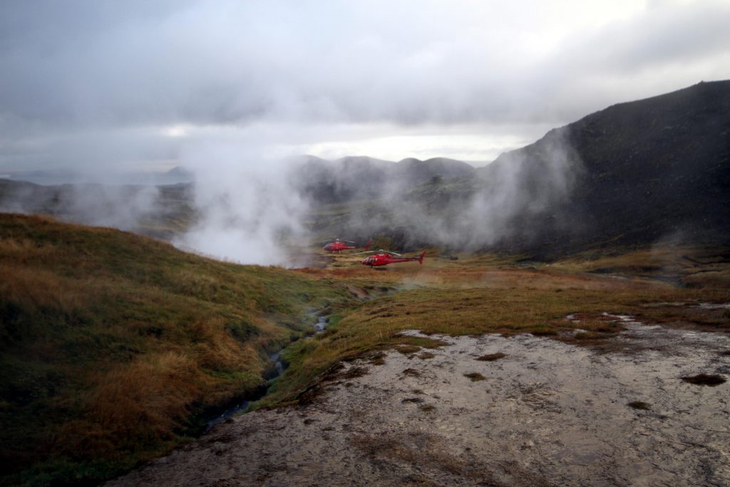
You can also get here on foot or on horseback and take in the surrounding landscapes at your leisure along the way. Perhaps the most pleasant way to approach nature!
Here you can find a hike around Hengill on GPSies.
In the south of Reykjanes lies the Gunnuhver geothermal area
At the very south of the peninsula you’ll find what is probably the hottest area in all of Iceland: in the Gunnuhver geothermal area, temperatures of over 300°C have been measured, and the fumaroles, hot springs and mud pots here are correspondingly active.
The region is volcanically extremely active — mud pots regularly explode when they briefly dry out, hurling hot clay several meters across the landscape. The area is often closed off, and when it isn’t, you should explore it with great caution. Today there are wooden paths and information signs here that tell, for example, the story of Gunna, the ghost of an Icelandic woman who gave the place its name.
For about ten years now, a crater has also been slowly forming here — another sign of the enormous volcanic activity in this part of the country.
In the north you’ll find the Þeistareykir high-temperature area
The volcano Þeistareykjabunga is probably the driving force behind the Þeistareykir geothermal area and makes the earth smoke and steam here in the highlands.
The region ultimately received a lot of media attention, particularly because of the dispute over property rights, which would affect the planned construction of a power plant. In the meantime, drillings have been approved and the first turbines for the power plant have been delivered to Husavík, to be transported into the highlands from there. The energy is to be used by an aluminium factory, which is also under construction.
This region is especially worth seeing in summer, because at that time all the colors of Icelandic nature mix wildly: the green of the moss on the red and yellow stones, the light brown earth and the grey mud in the bubbling pots. Add a light blue sky with a few little clouds and you have a perfect backdrop.
In the immediate vicinity are the lava fields of the Krafla volcano and the volcanic crater Viti. These are also the access routes, and as far as I have been able to research so far, from here you can only continue on foot to the hot spots. Please write us in the comments if you’ve already been there and we got something wrong or something is missing!
Map of geothermal areas in Iceland
On this map we’ve marked the geothermal areas mentioned above. If we’ve forgotten one, feel free to tell us in the comments and we’ll add it.
Conclusion: geothermal areas in Iceland
Geothermal areas are fascinating exhibitions of nature, in which our planet puts its interior on display a little and gives our imagination a glimpse behind the scenes.
If you don’t feel a sense of awe here, you probably have too little imagination or have watched too many movies: just a few hundred meters beneath your feet, glowing magma flows along under the earth’s crust. Constantly searching for a way to break through the rocky crust. The columns of steam and smoke are only relatively quiet witnesses of the forces at work not far from where you are standing.
In childlike carelessness you might forget here and there that you are out in nature, and there are no scheduled performances here: at any time a mud pot can spit forcefully, a geyser can erupt, or a small or large earthquake can shake the ground. So you should act carefully and considerately. If you do, you can learn a lot and get a little closer to your home planet.
Iceland has even more high-temperature areas to offer than the ones mentioned above — many are deliberately not developed for tourism, and others we simply haven’t found yet: write us in the comments if we’ve forgotten something important.
Have fun in Iceland!
[…] you see on this tour, summarized once more: Glymur waterfall, Þingvellir National Park, Hengill geothermal area, Hengill volcano, Nesjavallavirkjun, Hellisheiðarvirkjun, Bláfjöll mountain range, Reykjavík, […]
[…] in which you can take a relaxing bath even in snowfall and sub-zero temperatures. The surrounding geothermal area offers plenty more to see on top of […]