
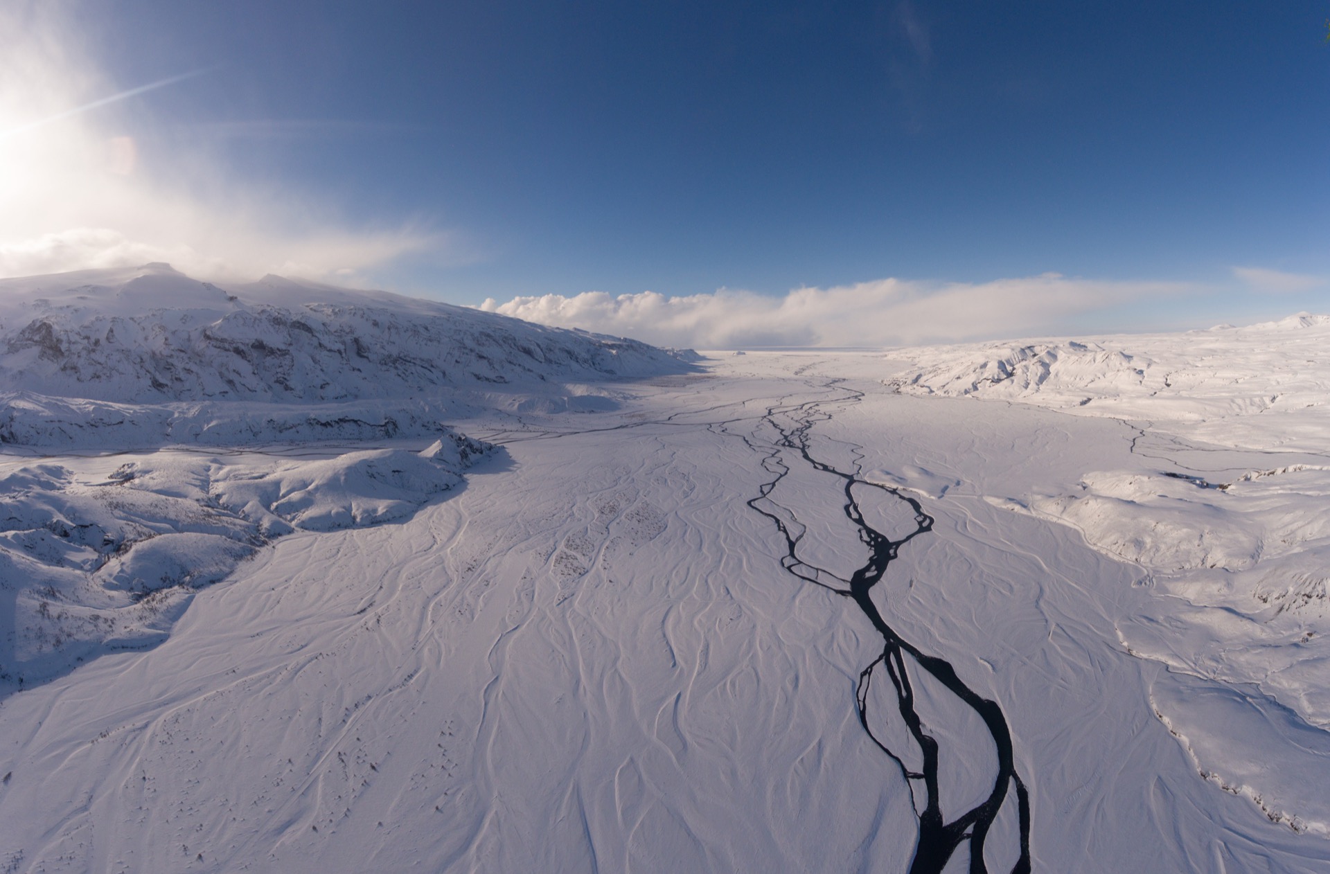
Þórsmörk in Iceland is a beautiful hiking area at the foot of Eyjafjallajökull in the south of the country. A few years ago the land was declared a nature reserve, which makes the area even more interesting for visitors and tourists today. This is above all a place to marvel at nature, and the best way to do that is on foot. Various hiking trails lead through the valley, up to the glaciers Tindfjallajökull and Eyjafjallajökull, or along the rivers Krossá, Þröngá and Markarfljót.
In this post we want to share everything worth knowing about Þórsmörk, tips and more about the region, how to get there and what to do once you arrive. Let’s go…
Þórsmörk / Thorsmoerk – Thor’s Forest at a Glance
The area of Þórsmörk is named after the highest god Thor and strictly speaking only refers to the northern flank. The southern part of the region is called the land of the gods – Goðaland. If you use the term Þórsmörk, though, everyone will know what you mean.
Unusual for Iceland: the flora and fauna of the region. There are plenty of trees, shrubs and flowers here, and you can even come across the ever-popular Arctic foxes. Most of the trees are downy birches. As a pioneer species this tree is particularly good at colonising new terrain, which is obviously an advantage in Iceland. Its biggest edge is probably that it copes well with very acidic water. That is a serious problem for other tree species, which is why they don’t feel at home here.
There was even a settlement here once, consisting of a few farms. They are gone today, as farming in this area proved extremely difficult. As a consequence, the area was declared a nature reserve in 1924.
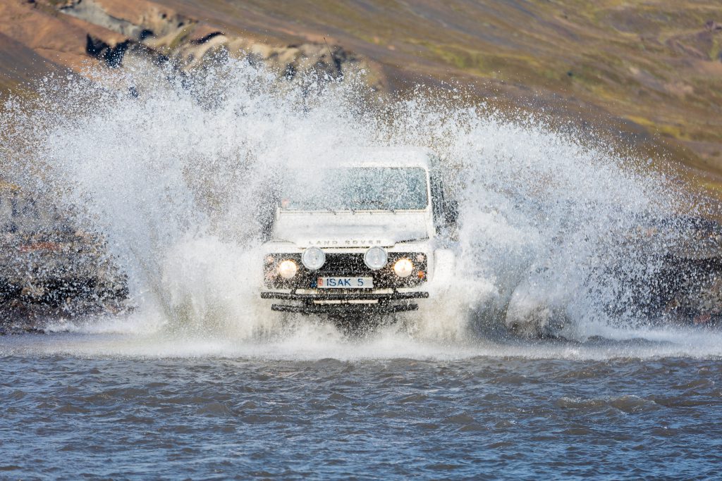
Getting here is only possible by 4×4 or highland bus, and the drive is no joke: several rivers have to be crossed. Nothing for beginners, and definitely nothing for winter. Real caution is required here, and probably not every ordinary 4×4 can keep up with the strong currents. A certain ground clearance and a certain amount of driving skill are essential. The route leads from Reykjavík along the Ring Road (1) to Hvolsvöllur and from there east on roads 261 and F261.
The entire region is part of the Katla Geopark.
Hiking in Þórsmörk / Thorsmoerk – Trails, Routes and Maps
There are several well-known hiking routes in the region. In this section we want to introduce them with all the information you need to prepare.
Hiking the Stakkholtsgjá canyon in Þórsmörk / Thorsmoerk
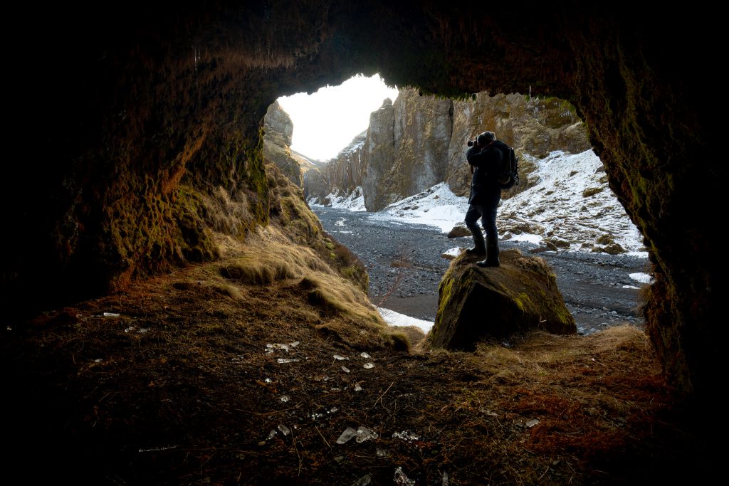
The Stakkholtsgjá canyon lies south of Þórsmörk, a little west of the Básar hut, and is one of the most popular hiking routes in South Iceland. The canyon is about 2 km long and can be up to 100 m deep. A small river runs through it, branching again and again and taking on different shapes depending on the weather and the water level. If you want to hike here you are well advised to wear waterproof footwear – rubber boots are probably the best option.
At the end of the canyon a small but very impressive waterfall awaits, hidden inside a cave. Seen from the entrance of the canyon, keep to the left and look out for a small crevice with a little stream flowing out of it: this is where the waterfall hides, and it is easy to miss!
The canyon is between 20 and 30 metres wide and the hike takes between two and three hours. For a day trip you can take the highland bus from Seljalandsfoss, which gives you about 3 hours on site – enough for the hike and a short visit to the waterfall, though many say a longer stay is not a bad idea here.
I would rate the difficulty of this hike as very low; online you will even find recommendations for doing it with children. By now I can confirm that, because I hiked there with a family whose son was about 11 years old.
Hiking up Valahnjúkur in Þórsmörk / Thorsmoerk
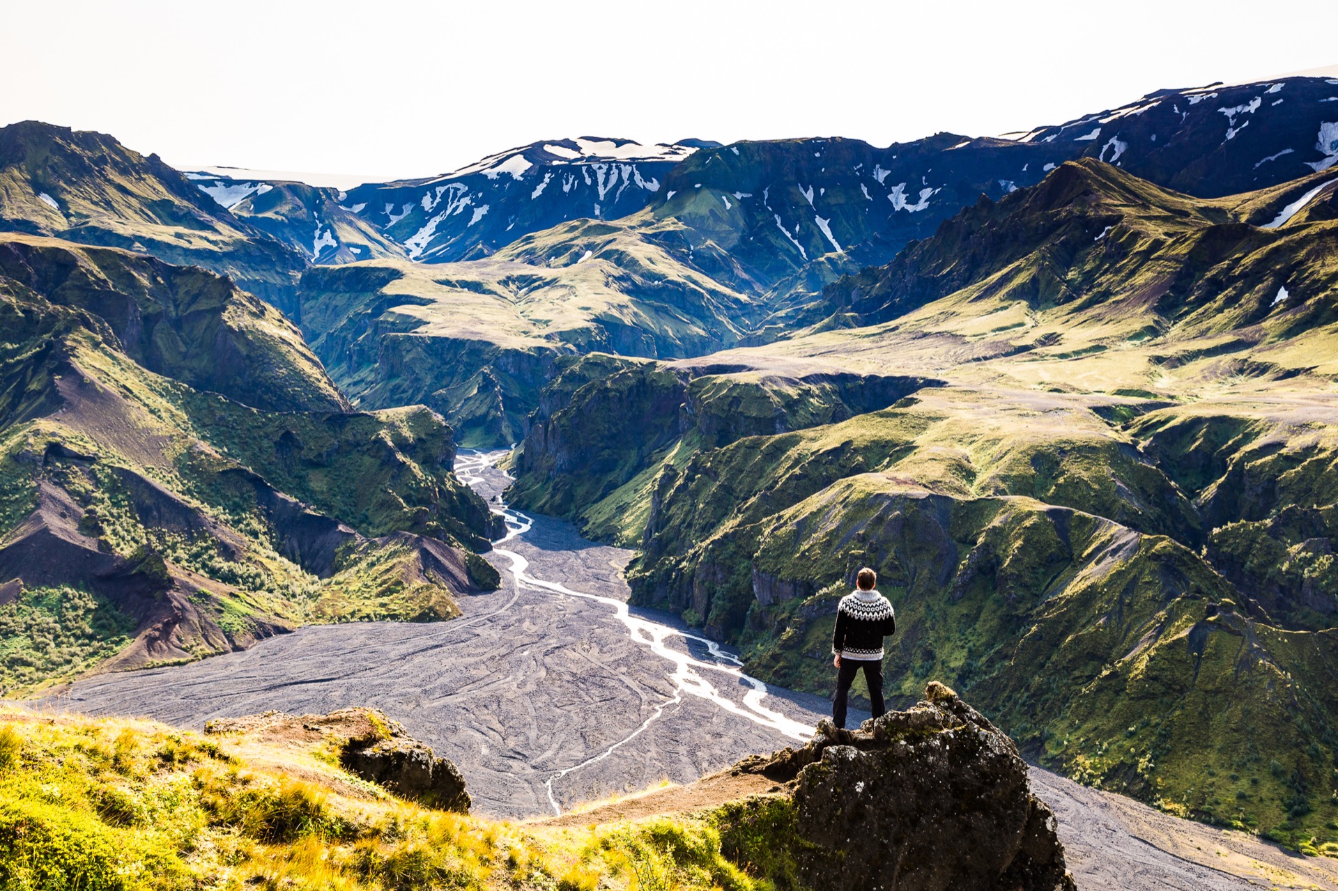
Valahnúkur is a relatively small mountain in Thor’s valley, but from its good 450 m of height it offers a great view in all directions: to the south you look out over Goðaland, with all its small river braids and rugged landscapes, all the way to the glaciers Eyjafjallajökull (south) and Tindfjallajökull (north).
The first stretch of the hike is fairly relaxed and can easily be done by travellers with little stamina and experience; towards the end the terrain gets a bit more difficult.
Two (or more?) trails lead up the mountain, so it can be fun to use one for the way up and the other for the way down. Just remember that in the end you have to get back to where you need to be (car, bus, hut…). Using local maps or a GPS device is recommended, but if you don’t have or don’t want to use those, you can at least drop a marker in Google Maps at your starting point.
In the Iceland podcast with Jeroen Van Nieuwenhove I learned that Google’s maps are not well suited for navigation here. Open Street Maps are said to be much better.
Hiking through Markarfljótsgljúfur (Markarfljot) in Þórsmörk / Thorsmoerk
The Markarfljótsgljúfur canyon lies north of the two sights mentioned above and sits right on the Laugavegur hiking trail in Iceland. The canyon is an impressive 4 km long and more than 200 m deep at its deepest points. It is believed to showcase the impressive power of Katla, as it was presumably carved into the landscape by a single flood wave.
Today the Markarfljót flows relatively calmly and leisurely through the rocks, which gives you extra perspective on the force that great flood must have had some 2,000 years ago.
You reach this side of the area by taking the F261. No walk in the park, because you have to cross many rivers along the way, and a hike always follows on top. I would only recommend this if you know your vehicle and know exactly what you are doing.
Alternatively there are guided tours into this area, which are less dangerous but certainly no less adventurous and exciting!
Coordinates: 63.7488, -19.3833
Sights and Tips for Þórsmörk / Thorsmoerk
Besides the hiking routes the area is known for, there are a few other sights you shouldn’t miss – provided you spend a whole weekend or more here, because with only a few hours on site it is simply impossible to see everything.
Almost exactly north of Eyjafjallajökull, between the mountain ridge and road F261, lies a former glacier lagoon (similar to the Jökulsárlón glacier lagoon), which was completely buried by debris when the volcano erupted in 2010. Today, on the satellite images on Google Maps, you can only make out a kind of pool made of rocks. At the upper edge a small glacier tongue still reaches down, and if you pull up pictures of Jökulsárlón for comparison you can run some fascinating thought experiments.
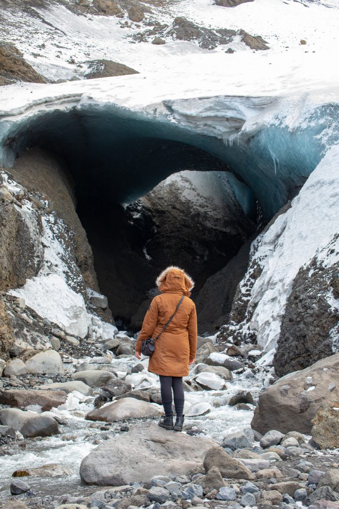
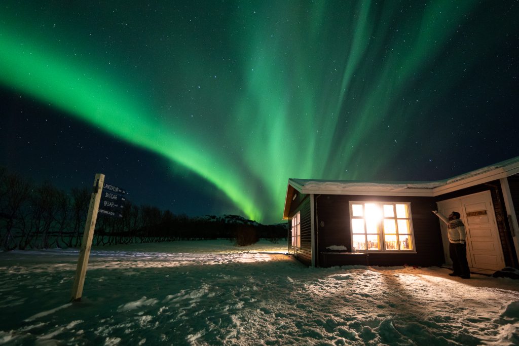
Two more sights can only be admired in winter, as they remain shy and hidden from the human eye in summer: northern lights and Arctic foxes. While the northern lights really are only visible in winter, the little foxes simply become more trusting in winter and venture closer to the people in Þórsmörk. At this time of year they are also often hungry and on the lookout for food, which is why they tend to come ever closer to the buildings here. If you have a good camera with you, you can take pictures not only of the little furballs but also of the northern lights in Iceland.
If you like to move a little faster, you can also do trail running tours in Þórsmörk. I imagine that to be very exciting, and if I weren’t so fat and lazy… oh well! In any case, you can for example run the complete Laugavegur and Fimmvörðuháls in three days, passing sights such as the Eldgjá crater and the Ófærufoss waterfall along the way. Two places that probably only a tiny fraction of all visitors to Iceland have ever seen!
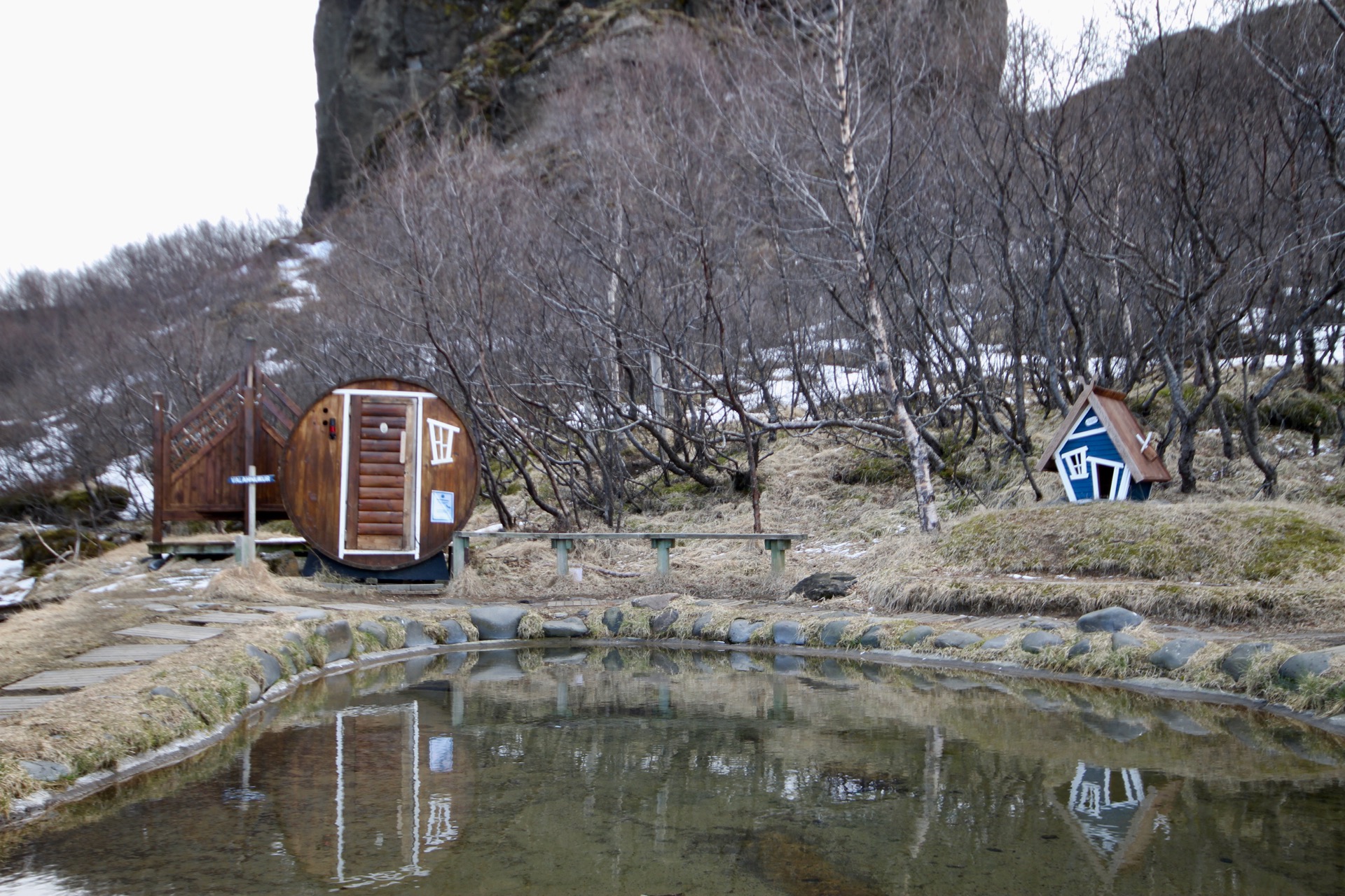
There are no natural hot springs in Þórsmörk – at least none that are publicly accessible – but you can use the sauna and pool at the Volcano Huts for a small fee. After a long day on the trail that is certainly a great option!
Hiking Maps for Þórsmörk / Thorsmoerk
I have to admit I am not a particularly good hiker in the traditional sense, because I have never used hiking maps in my life.
The best option seems to be buying hiking maps directly at the Volcano Huts, where up-to-date maps are always available for sale.
I mostly hike the better-known trails anyway, and you can find those for example on GPSies. There you can download route data and load it onto your smartphone or GPS device.
You can get hiking maps on site, and those are probably a good option too, because the guides will know them if in doubt, or even use them themselves.
If you have more information on this, I would love to hear from you in a comment!
How Do You Get to Þórsmörk / Thorsmoerk?
Getting to Þórsmörk is not trivial, but doable: you definitely need a suitable rental car with four-wheel drive and high ground clearance. On the way to the sights of the area and to the huts you have to cross several rivers: most of them are relatively shallow and fairly easy to manage. The last, big river on the way to the huts is a different beast: you are well advised to only ford it if you really know what you are doing, or have someone with you who does.
I was there with Jeroen van Nieuwenhove in a lifted Defender, and thanks to his skill all the river crossings were smooth and comfortable. That is surely simply down to the fact that he is here often and learned it from the experienced drivers of the region: experience is everything here.
Fording rivers can cause extreme damage to your rental car, not to mention the danger of you or your passengers getting hurt: better not to take a risk here that you may not be able to judge!
Staying Overnight in Þórsmörk / Thorsmoerk: The Volcano Huts
If you want to spend one or more nights in Þórsmörk, there is no way around the Volcano Huts. Beyond the huts themselves there is something for everyone: dorm rooms for travel groups, double rooms for couples and solo travellers, and entire cottages for families. In summer there is also the option of glamping right under the starry sky, without having to give up the comforts of solid accommodation. For hikers there is a hut in the mountains, and for everyone travelling with a tent there is a campsite right next to the main house.
Here you can find all the accommodation options at the Volcano Huts.
Getting to Þórsmörk / Thorsmoerk by Bus?
Between May and September a highland bus runs towards Þórsmörk, and for most people this is probably the easiest way to get there without much effort.
The exact timetable is set anew every year, just like the prices. For 2018 this is still pending.
In winter the bus does not operate and getting into the highlands becomes a bit more difficult. There are many operators of private tours, but they are not exactly cheap. That is mainly because in winter you won’t get anywhere even with a regular 4×4 – the vehicles have to be specially prepared: so-called super jeeps with huge tyres and special drivetrains. Not everyone can or wants to drive those, especially not with guests on board. Certainly a unique experience that simply has its price – and is surely worth every cent!
At this time of year the Arctic foxes are very trusting, and the distance from places with street lighting etc. also enormously increases your chances of seeing the northern lights.
Camping, Tents and Huts in Þórsmörk / Thorsmoerk
First things first: Þórsmörk is a nature reserve, and accordingly camping is not allowed here (drones are not allowed to fly here either). So you may neither camp here nor park a campervan nor do anything along those lines.
Throughout the whole area, including along the Laugavegur hiking trail, there are huts that can be used, and they also have adjoining campsites: only there are you allowed to pitch your tent. There are several good reasons for this – above all, nature is to be protected and preserved.
One of the best addresses in Þórsmörk is, probably without competition, the Volcano Huts. Their campsite is open between 1 May and 31 October and costs 2600 ISK (approx. €20) per person. Registration is only required for groups of 10 or more people.
In early 2018 I stayed at the guesthouse of the Volcano Huts and can highly recommend it: my room had a two-level bunk bed and the best view towards the valley, where the northern lights are usually easy to see. The adjoining restaurant offers everything your heart desires: breakfast, lunch and dinner as needed, plus cold (beer, coke, juices) and hot drinks (coffee and tea). Just the thing after a hike!
At this point I would also like to mention Jeroen Van Nieuwenhove again – you can admire his wonderful photos of Þórsmörk there and soon also order them as prints!
Arctic Foxes in Þórsmörk / Thorsmoerk
One of the most beautiful sights in Þórsmörk is a little ball of fur, has four legs and roams the landscape on them all year round: Arctic foxes.
The cuddly little faces feel very much at home here, and in winter they even become so trusting that you can admire them from a few metres away. In summer they keep a bit more distance.
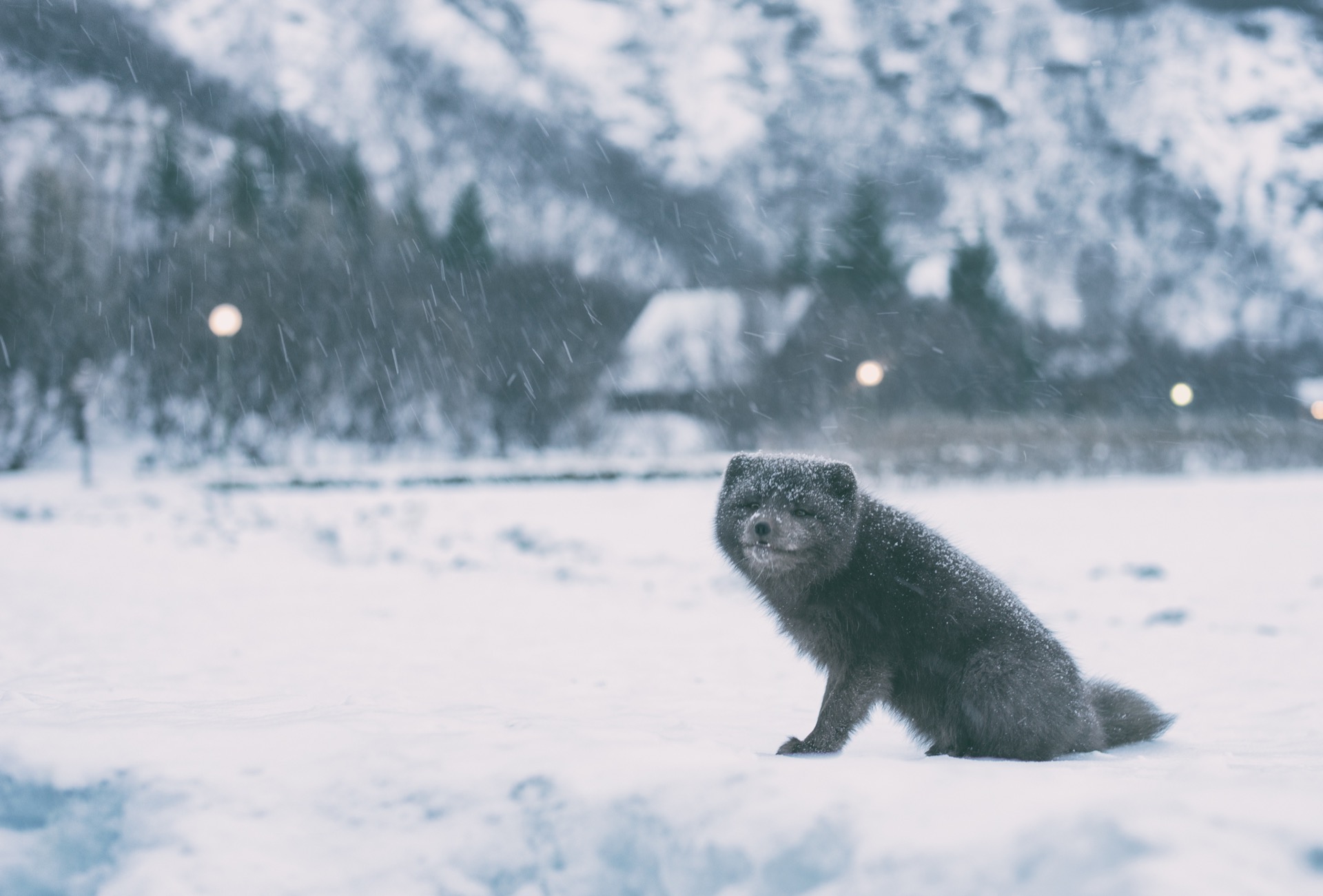
The only place where you get to see more Arctic foxes is the Westfjords of Iceland, and there above all the Hornstrandir nature reserve. Up there the population is relatively large, but you won’t get closer than a few dozen metres to the little rascals. In the rest of the country you need a lot of luck to catch sight of a fox at all, because they usually run away immediately when a human can be seen or smelled.
Similar to the northern lights, however, I would recommend not making your visit dependent on spotting an Arctic fox: just like with the aurora, there are simply no guarantees with wild animals, and even a longer stay can of course pass entirely without a sighting.
Verdict on Þórsmörk / Thorsmoerk: Iceland at Its Purest!
I hope we have brought together the most important information in this article in a compact yet thorough way, so that it helps you plan your trip to Þórsmörk.
Þórsmörk is one of the few places in Iceland that still receive relatively little tourism, though this will probably change in the coming years due to its proximity to Reykjavík: we hope the area can preserve its natural character, and the fact that it is a nature reserve helps sharpen visitors’ awareness of the fragile nature here.
In this article we cannot convey everything that is important for a visit from our point of view: we ourselves don’t know how to ford a river, when it is possible and which vehicle is best for it. But the right people to ask are mentioned in this post – and if a question still remains open, feel free to write us a comment or an email!
Have fun in Iceland!
P.S. Here are a few more beautiful photos by Jeroen…
(Updated on 24 September 2023. This article contains affiliate links.)
No Comments Yet