
Þingvellir — many people know this name even though they can’t pronounce its first letter, let alone type it on their keyboard! Iceland’s best-known national park is only about an hour’s drive from the capital Reykjavík and is home to many sights. In this post I want to give you some background that should help you understand the park better and get a better overview once you’re there.
Since the official boundaries of the park only cover a small part of the area, let me note that I’ll be covering everything that can be reached from the park within a relaxed day trip.
In the Iceland app there is a matching tour with audio commentary covering all the places described here, along with additional information.
Let’s go — off to Þingvellir…
The history of Þingvellir National Park
Þingvellir was formed millions of years ago, when the North American and the Eurasian continental plates began to drift apart. This created a rift valley between the tectonic plates that widens by 2–4 cm every year.
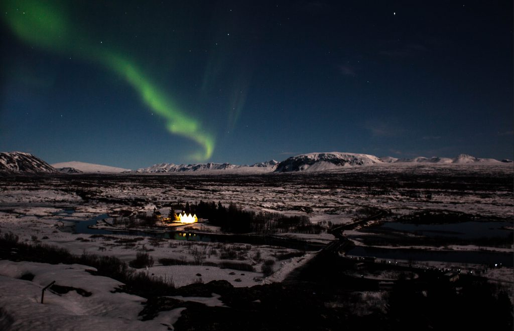
The first historical mention dates back to the days of the first settlers in the ninth century. At that time, various groups of people from all over Northern Europe came to Iceland to settle here. After a while it became clear that living together requires rules, and so in the year 930 the Alþing was established here — a parliament that both passed laws and handed down verdicts based on them.
Beyond that, people met here regularly, as paths from all over the country converged at this spot. Meetings and assemblies were regularly held in the Almannagjá gorge.
And in 1944, the Republic of Iceland was finally proclaimed here.
Iceland’s Alþingi, the parliament of Þingvellir
Established in the year 930, the Alþingi is Iceland’s parliament to this very day. Not without changes, of course, but essentially unchanged in its basic form. In old Iceland there were so-called goðorð (chieftaincies) — you can think of them as communities, each with something like a mayor. Smaller disputes were settled there directly. At some point, however, it seemed sensible to establish nationwide legislation. Ulfjot, a wise man of his time, was sent to Norway to see first-hand how things were done there. After his return he established a system of law through the Alþingi based on the Norwegian model.
Every year around the summer solstice, the assembly convened here in the valley between the continents, surrounded by four active volcanoes. Every goði of suitable age and wealth had to take part in the assembly. Only a few free farmers, the old and the sick were allowed to stay away. The goal was to administer justice, and to do so the law speaker had to climb the Lögberg (Law Rock) and recite from memory all the laws enacted up to that point.
The geography and volcanology of Þingvellir
In this section I’ll hand over to volcanologist Florian Becker of Vulkankultour, who as an expert can tell you a thing or two about the geography and the volcanoes of Þingvellir National Park.
Since Alfred Wegener we have known: the continents of the Earth are moving. Sometimes they drift towards each other — then things crash and mountain ranges like the Himalayas or the Alps are formed. Sometimes they scrape past each other, accompanied by heavy earthquakes, as at the San Andreas Fault in California. Or they drift away from each other — in that case the movement is usually quite gentle and wide valleys form, called a “tectonic rift” in geologist speak.
At such fault zones the thin crust of the Earth is literally torn open, and under favourable geological conditions molten rock can rise from the Earth’s mantle all the way to the surface and build mighty volcanic chains — the so-called “mid-ocean ridges“. At over 60,000 km in length they are the largest mountain ranges on Earth — only, unfortunately, completely invisible to us, as they lie beneath the surface of the world’s oceans. But a small part of this mountain chain sits on (or rather forms) the island of Iceland, which has risen several kilometres from the floor of the Atlantic to above the water’s surface. Here we can actually see the Mid-Atlantic Ridge on land!
Here, too, the pieces of the Earth’s crust known as the “Eurasian” and “North American Plate” are moving away from each other. At a speed of around one centimetre per year they aren’t exactly fast (for comparison: the Ferrari among tectonic plates is the Pacific Plate, drifting northwest at a breathtaking 10 centimetres per year). But this movement, constant for millions of years, has left its mark on Iceland: in many places the Earth’s crust tears open, and a rift valley several kilometres wide has formed. Nowhere can you see this more beautifully than at Þingvellir.
The rift zone here runs north to south; the valley is already around five kilometres wide and grows by an average of two centimetres every year. Numerous parallel fissures run alongside it, and the most famous of them has even been given a wonderful-sounding name: “Almannagjá“, the “gorge of all men“. It was at this spot, in the year 930 AD, that for the first time “all men” — or rather all the major farmers known as goðar — came together from all parts of the newly settled island. They passed laws by majority vote and thus, just like that, in the middle of the deepest Middle Ages, created a democracy that still exists today — making it the oldest surviving democracy in the world. The “Alþingi“, or Althing, was born.
From this historically momentous place you have a wonderful view north towards Skjaldbreiður, the “broad shield”. It is essentially the mother of all shield volcanoes, a product of the never-ending volcanic activity in the continental rift. The low viscosity of its lava is the reason its slopes are so gentle and the volcano covers such an enormous area. Like a Viking shield it rises majestically above Þingvellir, its softly climbing flanks forming a perfect cone, covered in snow almost all year round. The icing on the cake of a geologically and historically magical patch of Earth….
If you’re interested in volcanoes, be sure to check out Vulkankultour! Thanks for the contribution, Florian!
Þingvallakirkja – the church of Þingvellir
A church already stood here a thousand years ago, serving the visitors of the Alþingi for their church services. The church you can enter today dates back to 1859 and makes a lovely, warm impression. With all its wooden elements the building feels like a cabin. Right next to it lies a small cemetery where only a handful of people found their final resting place. The church is open from 9 am to 5 pm.
Sights in Þingvellir
The national park is packed with sights. I’m stretching the boundaries of Þingvellir quite a bit here, though, and talking about everything you can reach from here within one to four hours by car. The national park itself is relatively small and essentially only covers the northern part of the lake and the surrounding sights along the shore.
In the wider catchment area of the national park, however, you’ll find all kinds of attractions.
Waterfalls in and around Þingvellir
First and foremost, at Þingvellir you’ll find the waterfall that forms the crowning finale of the Golden Circle: Gullfoss.
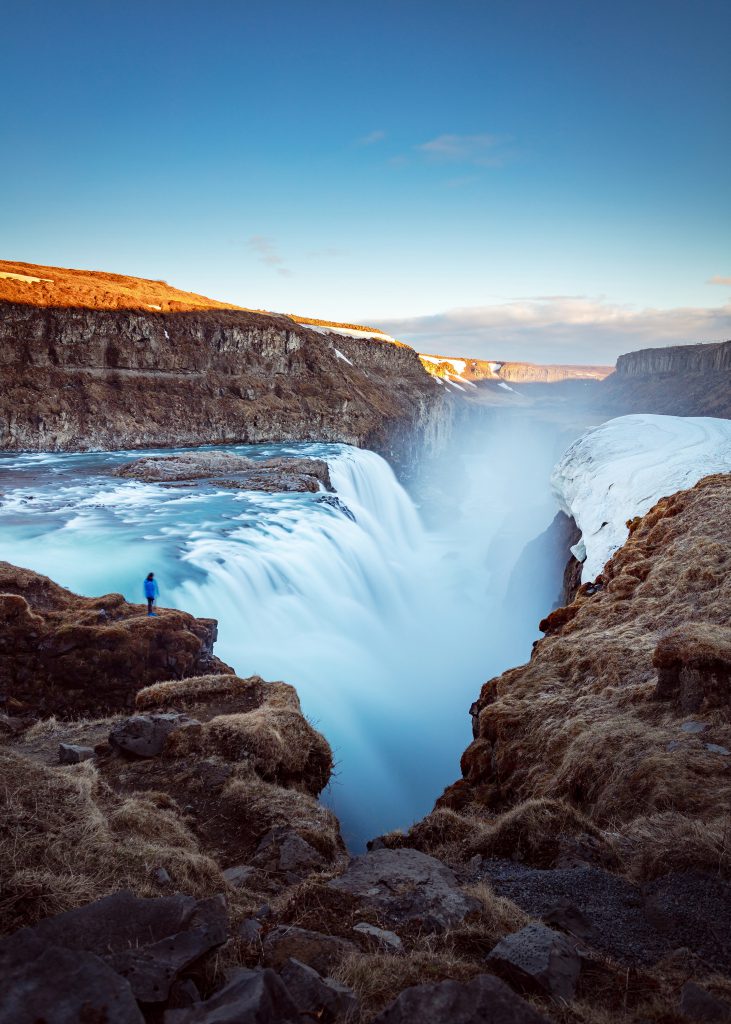
Gullfoss is probably Iceland’s most famous waterfall and is visited by hundreds of thousands of people every year. In summer it often dresses itself up with rainbows, and in winter you often see little more than a huge, massive wall of ice framed by the snow-covered rocks all around. Either way, the big waterfall is imposing — it plunges more than 30 m down over two tiers. A hydroelectric power plant was once supposed to be built here, which a courageous Icelandic woman managed to prevent. Her story is told on the plaques along the walkways.
Less well known but no less beautiful or impressive is Brúarfoss. This waterfall is defined by its wonderful blue colour, and depending on the time of day, the position of the sun and the weather, you can take incredible photos here. Brúarfoss only drops about 10 m, but it impresses not with its power but with its beauty. By the way, it makes a great stop on the way to or from Gullfoss.
Right next to the sights of the Alþing there is another small waterfall called Öxarárfoss. It is man-made and diverts the river Öxará towards the Almannagjá gorge. This was presumably done to supply the assemblies with water. One story has it that criminals and unfaithful wives were beheaded here, which sounds plausible when you consider that the name translates to “axe waterfall”.
Hot springs in and around Þingvellir
Right near the geyser Strokkur — which in a way you can also consider a hot spring — you’ll find two more natural hot springs, Marteinslaug and Kúalaug. They are not suitable for bathing: they are very small and very hot, and they’re not built for the tourist crowds either.
If you want to go for a proper soak, Gamla Laugin, the Secret Lagoon, is the place to go. There are changing facilities and a large hot spring you can bathe in with several people. The Secret Lagoon is often recommended as a good alternative to the Blue Lagoon.
Right next to it is (or was) Hrunalaug: sadly you can no longer visit this hot spring, as it was destroyed more and more by tourists over the years. I’m afraid I don’t know the current status — it’s either closed or simply so devastated that you can’t go there anymore.
Also on the way to Gullfoss you’ll find Laugarvatn Fontana. This hot spring is well developed and can handle larger numbers of visitors without a problem. You can also enjoy a sauna here and try bread baked with geothermal heat. Fontana is a good mix of the Blue Lagoon and the Secret Lagoon.
Activities in Þingvellir
The best-known activity in the park is probably diving. The dive site Silfra is world-famous among divers, and even if you don’t have a diving licence you can get a glimpse of the unique underwater world of the rift zone between the continents as a snorkeler. Snorkeling tours are run by a wide range of operators and are a truly unique experience, whether in summer or winter. Diving in Iceland may not be the most obvious activity, but I still want to warmly recommend it to you!
If you prefer to stay dry, all you need is a sunny day and a horse under your bum. Several farms in the area offer riding tours along the Golden Circle. You can go for a ride either right inside the park or along its edges. A particularly well-known farm is the Laxness Horse Farm, located between Reykjavík and the park. From here you can book one-day or multi-day tours and combine them with trips to the Blue Lagoon or the Golden Circle.
One very special activity is only possible in winter: dog sledding simply requires a bit of white splendour on the ground. Luckily that’s rarely a problem in winter, as it snows almost constantly in the park and the snow tends to stay around for a long time. Before heading out on tour, by the way, you “have to” spend some time with the dogs and cuddle them so they get used to you. There are worse things, I think.
Hotels and other accommodations in Þingvellir
First and foremost, the ION Hotel deserves a mention here. Not a bargain, but if you want to treat yourself you’ll find an oasis in the lava field. Besides the beautifully furnished rooms, a luxurious spa area and a restaurant with a breathtaking view, the hotel also offers all kinds of tours around Þingvellir.
Hidden away deep in the highlands you’ll find the Highland Center Hrauneyjar. The offerings here range from small double rooms to suites. Breakfast and dinner are available, and the surroundings invite you to hike and explore.
If you prefer something more homely and private, you can settle into one of the many lodges and guesthouses. Many of these cabins are summer houses owned by people from the capital, and thanks to booming tourism they have become an attractive source of income for their owners.
The Jaðar Holiday House is located very close to Gullfoss and has room for a whole family. Another gem in the area is the Brekkugisting Villa, a log house very close to the Brúarfoss waterfall. It also fits a whole family, and you have your very own hot pot right in front of the house.
You’ll also find great places to stay in the area on Airbnb. If you sign up with Airbnb via this link, you’ll get €35 towards your first trip as a gift. Right by the Geysir, for example, there’s this lovely little house, around Laugarvatn there are the Blue View Cabins and this summerhouse with a lake view.
Tjaldsvæði – campsites in Þingvellir
There is also a campsite in the park, located right next to the visitor centre in the immediate vicinity of the sights. You can find more information here. The sites are open from June to September, and they are very well maintained and supervised.
Finding the best hotels / accommodations with the Iceland app
I’d like to take a little detour here and show you how I researched the accommodations above, in the hope that it helps you with your trip planning for Iceland. In the Iceland app you can display various kinds of places — hotels, but also campsites, gas stations and supermarkets. Both on the map and based on your current location or any other location.
A few examples: You know you want to visit Svartifoss and that it will be your last stop of the day. You can now look up Svartifoss in the Iceland app and, with one tap, display the 5 nearest hotels. Or you’re driving along and notice you’re running low on fuel: the Iceland app can show you the nearest gas station and navigate you straight to it.
Silfra: diving and snorkeling in Þingvellir
One of the most popular activities in the national park is diving. Here, right in the middle of the rift zone, lies one of the most popular dive sites on the planet. Silfra offers the cleanest water you can dive in, with visibility of well over 100 m — independent of weather or tides.
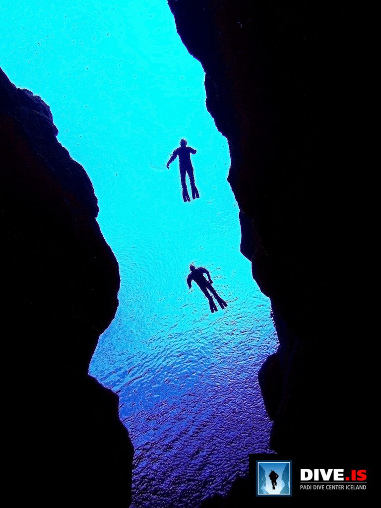
After melting off the ice of the Langjökull glacier, the water flows for several decades through the fine lava rock of the valley before seeing daylight again for the first time in the Silfra fissure. Thanks to this filtering it is so pure and clear that you can safely drink it. Pay attention to whether — or how often — your guide takes the regulator or snorkel out of their mouth 😉
Beneath the publicly accessible part of the fissure lies a deep and widely branching cave system. An American cave diver mapped it years ago and found depths of more than 60 m. Due to its fragility, the system is closed today. Tunnels could collapse here at any moment and block the way back.
As a recreational diver or snorkeler you therefore stay in the shallower parts of Silfra, but down to a diving depth of 18 m you are free to look around and admire the incredible sight of the blue shimmering rocks of the tectonic plates. You are literally between the continents — the North American plate on one side and the Eurasian on the other.
Snorkeling tours are offered by various operators; if you hold a diving licence and can show experience with drysuit diving, you should take a look at the tours for divers.
Map of Þingvellir
On the map below you’ll find all the sights mentioned above and a few places that may not be mentioned in the text. The map is meant to give you an overview; the Iceland app might also be helpful for navigation.
No Comments Yet